Kari Ann Schaffer
277 Tower Road, Warnerville, NY 12187
Phone: 518-391-1628
Email: KarebearsKrafts@gmail.com
Town of Fulton Historical Society (Not for profit)
Email us At: townoffultonhistoricalsociety@gmail.com
About Us:
The Mission of the Historical Society is to collect, preserve, and share the history of the Town of Fulton. We cover Breakabeen, Fultonham, West Fulton, and surrounding areas. We have a School House Exhibit, located on West Fulton Road, where the original school house stood. The exhibit is open every second and fourth Sunday, between Memorial Day and Columbus Day weekends, from 12:00 pm to 4:00 pm. Our monthly meetings are held the first Thursday of every month from April to December. Meetings are held at the Town Hall at 3:00 pm, unless otherwise stated on our Facebook page.
History:
The Town of Fulton was formed on April 15th, 1828. Fulton is the largest of the 16 towns in Schoharie County. It is located in the very center and is bordered by Summit, Richmondville, and Cobleskill on the north side, Middleburgh and Broome on the east side, Middleburgh, Broome, Gilboa, Blenheim, and Summit on the south side, and Blenheim and Summit on the west side.
Small Town Famous:
William C. Bouck – he was our first elected governor in 1842 and served for 2 years. His mansion still stands on State Route 30.
Timothy Murphy – he is a major figure in our town’s history. He was famous for being a frontiersman and knowing the ways of the Indians. He was a fantastic marksman with a rifle, and a member of Morgan’s riflemen. He was responsible for shooting British General Fraser at the Battle of Saratoga in October 1777, which was considered the turning point of the Revolutionary War. After the war, he became a farmer and mill owner in Vroomansland. He died June 27th 1818 and was buried in the family plot. He was later moved to the Middleburgh Cemetery.
Geography:
The highest peak in our town is the Petersburgh Mountain, measuring 2311 feet above sea level, which used to be the location of the fire tower.
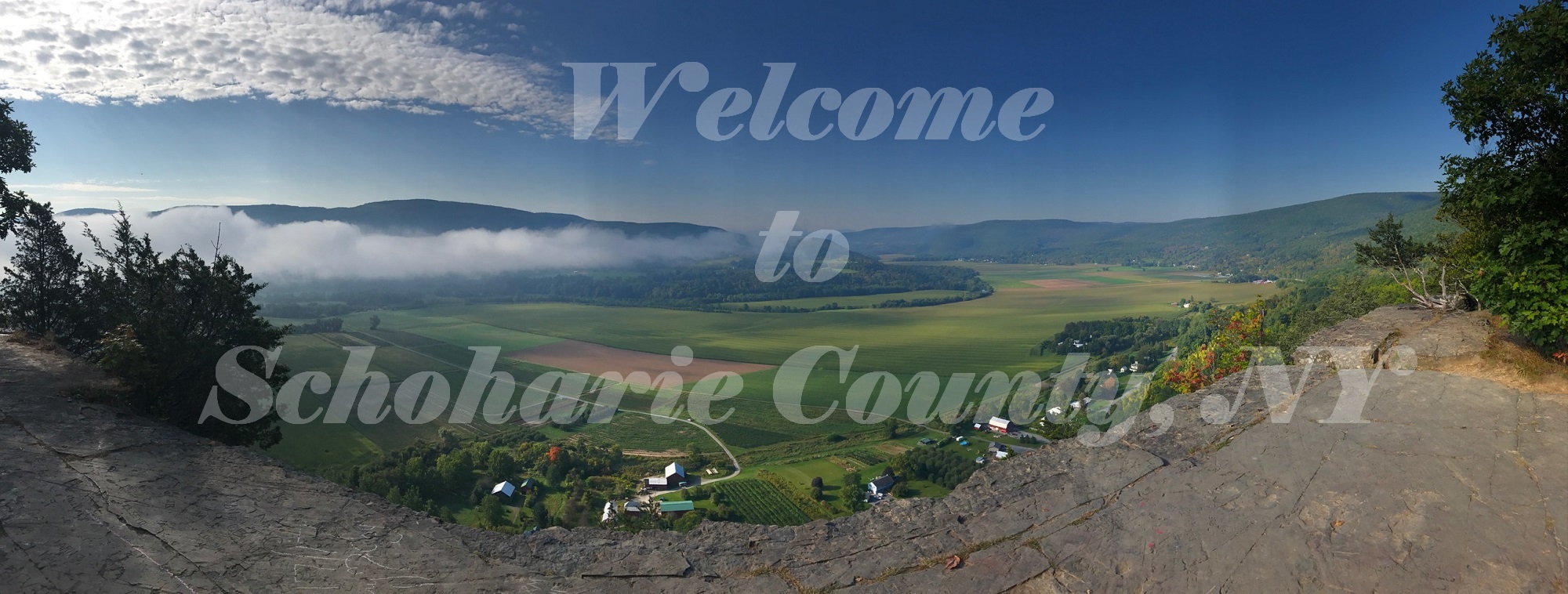
The Schoharie Creek is the largest stream that runs through our town. We also have multiple smaller streams, Panther Creek, Heathen Creek, House Creek, Keyser Kill Creek, Line Creek, Betty Brook, and a section of Cole Creek. We also have three ponds, Duck Pond, Mallet Pond, and Looking Glass Pond. Our most prominent geological landmark is Vroman’s Nose, which was called “Onistigrama”, meaning Corn Mountain, by the Indians. It consists of 34 acres and rises 600 feet above the valley.
Election Districts:
Our town consisted of three election districts in 1844. Election District #1 covered the hamlets of Fultonham (“Rabbit Bush”), Watsonville, and Church Street. Election District #2 covered the West Fulton (“Sapbush Hollow”) area, Rossman Hill, Huckleberry Kingdom, Morey Hill, Dibble Hollow, Yankee Street, Betty Brook, Patria-Greenbush, Masadonia, Vintonton, and Fairland. Election District #3 covered Breakabeen, Bush Road, Bouck Hollow, Armlin Hill, Keyserkill Road, and Bear Ladder Road. Today we only have one voting district.
Note from Town of Fulton Historian:
I hope you have enjoyed reading some of our history. If you want to learn more, the Historical Society has a variety of publications available for purchase. If you have an interest in joining the Historical Society, send us an email or message us on Facebook and we will get you an application.